 |
| Fiery fireweed sets the landscape ablaze in the Las Conchas burn. |
Wednesday, September 16, 2015
Fiery Fireweed
On Tuesday, walked with women's group from Pajarito Ski Area to Rosie's Point on Guaje Canyon Trail 282. Saw 2 groups of bow hunters - both empty-handed - and a lone backpacker with his dog. The cooler weather was absolutely perfect!
Monday, September 14, 2015
Taperleaf - Pericome Caudata - Along Nail Trail
A friend from the Nature Center wanted photos of a flowering plant, Taperleaf or Pericome Caudata. I promised that I would go back to the Nail Trail last Thursday to capture a portrait of said plant. Well, last Wednesday evening is when a jogger was attacked by a mother bear in Valle Canyon which is just a mile or so down West Jemez Road from where the plants grow alongside the Nail Trail.
After taking the photos, I continued up the Nail Trail, past the short, rocky section to where the trail opens up, flattens slightly and turns left. Right there is where I heard a moan - could have been a vehicle on West Jemez Road but it certainly sounded like an animal. I scanned the thick growth of mullein but didn't see anything. Just in case, I picked up a thick stick and held it above my head to look tall and continued hiking uphill. Soon, I tossed that and picked up an even stouter stick which I clattered along the ground behind me to not surprise any bears. I honestly (perhaps, stupidly!) dragged that stick for a long time and I found a different way back down to my car.
After taking the photos, I continued up the Nail Trail, past the short, rocky section to where the trail opens up, flattens slightly and turns left. Right there is where I heard a moan - could have been a vehicle on West Jemez Road but it certainly sounded like an animal. I scanned the thick growth of mullein but didn't see anything. Just in case, I picked up a thick stick and held it above my head to look tall and continued hiking uphill. Soon, I tossed that and picked up an even stouter stick which I clattered along the ground behind me to not surprise any bears. I honestly (perhaps, stupidly!) dragged that stick for a long time and I found a different way back down to my car.
 |
| Taperleaf - Pericome Caudata |
Yeamans Bench
Last Tuesday, I walked up the west jeep road on Pajarito Mountain. When I got to the top, within sight of the holding pond, instead of continuing down the east jeep road, I strolled west over to Rim Run to admire the view into the Valles Caldera. Then, because it remained a splendid day with no threat of thunderstorms and not a reason in the world to hurry, I retraced my steps to the Mother Lift where I took a trail in the woods to the Yeamans Bench.
 | |
| On various visits to the Yeamans bench, I've failed to notice (or forgotten) the plaque on the front. It reads: Dedicated in loving memory of Steven Karl Yeamans October 8, 1959-January 11, 1999 by his friends and family. |
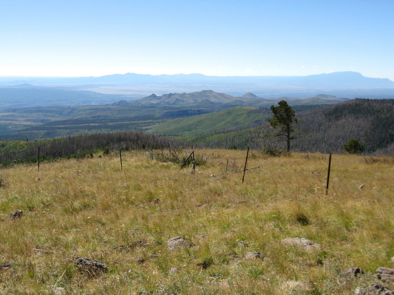 |
| The bench is situated on the south side of Pajarito Mountain and has sweeping views on which to contemplate. |
Thursday, September 3, 2015
Tough As Nails - Not Me!
 |
| At Nail Trail, very nifty sign made of nails. Legend is that someone put roofing nails on the trail resulting in lots of flat bike tires and thus the name. |
 |
| I say the trail got its name from this short, "tough as nails" section where you skip from rock to rock and hope to stay upright and unbroken! |
Thursday, August 27, 2015
Hikes from Past Week
 |
| From Frey Trail, Bandelier National Monument - clouds building. They "produced" on the drive home. |
 | |||||||||
| Along Canyon Rim Trail, yellow prairie coneflowers. |
 |
| Keddy Lake between Peralta Ridge and Cerro Pelado in Paliza Canyon. Who is it named after? |
 |
| Playing Heidi on Pajarito Mountain - took jeep roads up west side and down east side from the ski lodge. |
Wednesday, March 18, 2015
Notes to Self on Burnt Mesa Eagle Traps
The Monday group hiked to the Burnt Mesa Eagle Traps. There were 8 of us - the group is growing! I recently conscripted a friend to pre-hike to the Eagle Traps with me and what a good idea that was! On the pre-hike, I kept prematurely looking for what I call the bonus deer trap, which is a package deal along with the 2 eagle traps. Today, though, I knew just where to find it! (This somewhat relates to a cartoon that a hiking member sent out recently - "What do we want? Better memory! When do we want it? Want what??") But I know that by the next time I hike to the eagle traps, I will forgot again where the bonus deer trap is.
So, here are notes to jog my future memory (assuming I still have one): The important part is that the bonus deer trap is almost 2 miles into the hike - you are very close to the eagle traps at that point. The deer trap is located on a shelf just below and south of the mesa ridge. At its eastern end, the shelf is easily accessed by a short downhill on what looks almost like a wide, rocky road. Be careful not to trip on the metal stake that marks the deer trap as an archeological feature. My hiking friends call it a deer trap since it's wide and shallow. After visiting the deer trap, continue a little east of south and uphill. You will see almost a path at times, created by past visitors to the eagle traps. At some junipers, go downhill, over rocks, to the pair of narrow, deep eagle traps perched at the edge of Frijoles Canyon.
So, here are notes to jog my future memory (assuming I still have one): The important part is that the bonus deer trap is almost 2 miles into the hike - you are very close to the eagle traps at that point. The deer trap is located on a shelf just below and south of the mesa ridge. At its eastern end, the shelf is easily accessed by a short downhill on what looks almost like a wide, rocky road. Be careful not to trip on the metal stake that marks the deer trap as an archeological feature. My hiking friends call it a deer trap since it's wide and shallow. After visiting the deer trap, continue a little east of south and uphill. You will see almost a path at times, created by past visitors to the eagle traps. At some junipers, go downhill, over rocks, to the pair of narrow, deep eagle traps perched at the edge of Frijoles Canyon.
Friday, March 6, 2015
And the Winner Is...
This morning, the senior hiking group unanimously voted for the Powerline Point Trail. I managed to squeeze in a mere little adventure: Instead of going straight uphill to our usual overlook of the powerlines crossing high above the Rio Grande, we turned off onto the Ancho Rapids Trail. I took them to a small mesa that looks down on that steep, rough trail as it continues to Ancho Rapids, far below on the Rio Grande. On the way back, one of the hikers pointed out what he thought was an indigo bunting flying away. I'm no birder but the feathers of that bird were such a bright blue - beautiful!
 |
| Jemez Mountains and Los Alamos from Powerline Point Mesa |
Thursday, March 5, 2015
Tromping in Pueblo Canyon
Checked out the Sewer Plant Road, starting from the bottom of Main Hill Road (NM502). Intention: see if the first 2 miles have dried out enough after our recent snows to recommend it to a senior hiking group.
About a mile and a half in, I detoured to check out a side road known as the Pueblo Canyon Trail, although it's really just another dirt road. The group never takes this but always sticks to the main road, walking only as far as the Los Alamos Wastewater Treatment Facility and turning around. I thought this could be a chance to do something different!
It was OK at first but my shoes soon collected thick mud in the shady parts so I eliminated it as an option - not their preference. Since my shoes were already muddy, I decided I may as well continue up canyon! To do this, I'd have to cross the treated wastewater effluent stream. In the past, this involved finding a place narrow enough to jump over or a rock to step on and then continuing on the Pueblo Canyon Trail. It's more complicated now because part of the effluent stream has jumped downhill from its bank, eroding a steep-sided, muddy channel in the middle of the road; so now, you're leaping over onto very treacherous footing. Seems like a setup for a mud bath with bodily injury! I managed to find a place to step across further upstream, thanks to a thoughtfully placed rock, but then had to bushwhack through dry weeds and shrubs to get back to the road. Thoughts of ticks and rattlesnakes flashed through my mind but I dismissed them - too early in the season...I hope!
I continued up canyon just to where the Pueblo Canyon Trail joins the maintenance road and looped back there, following the thankfully dry road - past the wastewater treatment facility, past the composting station, past where I had first turned off onto the Pueblo Canyon Trail and back to my car. I went further than the group would but it was a fun - a mere little adventure, even the crossing of the effluent stream and tromping through mud. The Sewer Plant Road itself was fine - nice and dry! Yesterday, I walked the Powerline Point Trail and it is basically dried out as well - we'll see which the group picks!
 |
| Tent Rock Rooted in Pueblo Canyon |
Wednesday, September 17, 2014
Rabbit Ridge Road Elk Serenade
A group of us hiked this morning up the Rabbit Ridge Road, across from the Valle Grande. The sound of the bugling elk was beautiful! The day was overcast and temps were cooler, giving a feeling of autumn. Ordinarily, a day without our intense New Mexico sunshine can make me feel "down" but not today. My spirits were buoyed after this beautiful hike.
Some hikers went all the way to Rabbit Mountain and then took a short-cut down the mountain-side and back to the cars at Coyote Call trailhead. I went as far as the first felsenmeer and then walked alone back to my car. I wasn't really alone, though, because the bugling elk serenaded me from all around.
Some hikers went all the way to Rabbit Mountain and then took a short-cut down the mountain-side and back to the cars at Coyote Call trailhead. I went as far as the first felsenmeer and then walked alone back to my car. I wasn't really alone, though, because the bugling elk serenaded me from all around.
Thursday, May 1, 2014
Gotta Remain Strong As You Can As Long As You Can
Regarding the post title, as my body ages, I find myself repeating this mantra. Half the battle is showing up, staying upright and keeping mobile!
To that end, took a walk Monday on the Pueblo Canyon Rim Trail, starting from East Park and out to the top of the Camp Hamilton Trail. Took the easy way back on what I call the "Happy Trail", aka the Canyon Rim Trail. Guess I call it that because it's almost always sunny, it's paved, it's easy and it's a nice all-weather fall-back when I don't feel like driving to a trailhead.
I was pleasantly surprised that there was not a lot of litter along the section of the Pueblo Canyon Rim Trail below the county's Pajarito Cliffs Site parking lot. I haven't been on that part of the trail for quite a while. After getting bitten by a rattlesnake in June 2012 while picking up trash there, you might say the thrill was gone. Well, now that I've been back and got reacquainted with its spectacular views of our area mountains and Pueblo Canyon, I plan to return soon!
On the wildflower front, saw a few scraggly, yellow wallflowers, Tried to take their portraits but I've never mastered close-ups - all the photos were blurry - maybe I can blame the wind! I managed to capture a nice photo of a yucca almost ready to bloom. My success was in using the telephoto feature rather than the macro and steadying the camera on my broad-brimmed hat.
Subscribe to:
Posts (Atom)