I didn't see another sign like this further uphill forbidding motorized travel downhill but I only walked part of the road. FR181, also known as American Spring Road, begins just up the escarpment into the Jemez, off NM4, and winds it way down to West Jemez Road. It gets really rough on the descent; but even so, I've seen vehicles attempting it!
Monday, July 30, 2012
One Sign Does Not a Closure Make
This sign is at the eastern terminus of FR181 where it intersects West Jemez Road, near the twin water tanks. The "fine print" verbiage below Area Closed is not easily visible to my aging eyes. I did a double-take to be sure I wasn't breaking the law by hiking here.
Wednesday, June 20, 2012
Valles Caldera National Preserve: X Marks As Far As You're Welcome
Spouse and I walked Valle Grande Trail today. It's one of only two free trails offered by the Valles Caldera National Preserve out of miles and miles of trails and logging roads, of their total 89,000 acres of publicly owned land.
View toward Redondo/Redondito from endpoint of Valle Grande Trail. The X reminds you that if you didn't bring your wallet, you're not welcome to go any further - go back home!
The Valles Caldera National Preserve recently released a Draft Environmental Impact Statement on Public Access and Use. You can comment on it at their website or at the two public meetings planned.
View toward Redondo/Redondito from endpoint of Valle Grande Trail. The X reminds you that if you didn't bring your wallet, you're not welcome to go any further - go back home!
The Valles Caldera National Preserve recently released a Draft Environmental Impact Statement on Public Access and Use. You can comment on it at their website or at the two public meetings planned.
Quemazon Trail Regrowth
On Monday, hiked up Quemazon Trail to its intersection with Pipeline Road. The trailhead sign says it's 6 miles roundtrip and 1,400' elevation change. I didn't realize until I'd started uphill that it was a bit windy. Glad no trees crashed down! A little past the Knapp Trail turnoff, saw elk track, both large and small. Wonder if it was a mama and baby? Didn't actually see any animals, though, four-legged or otherwise.
There's a part of the trail, maybe 1 1/2 to 2 miles uphill, where there are acres of aspens that have grown since the 2000 Cerro Grande fire. It should be even more beautiful when the colors change.
The penstemons are waving in the wind. The red ones are Scarlet Bugler. The purple penstemons look a lot like the Rocky Mountain penstemons growing in our backyard.
More regrowth since 2000. A cavalcade of young ponderosas, planted by volunteers after the Cerro Grande fire, march up a hillside along the trail.
There's a part of the trail, maybe 1 1/2 to 2 miles uphill, where there are acres of aspens that have grown since the 2000 Cerro Grande fire. It should be even more beautiful when the colors change.
The penstemons are waving in the wind. The red ones are Scarlet Bugler. The purple penstemons look a lot like the Rocky Mountain penstemons growing in our backyard.
More regrowth since 2000. A cavalcade of young ponderosas, planted by volunteers after the Cerro Grande fire, march up a hillside along the trail.
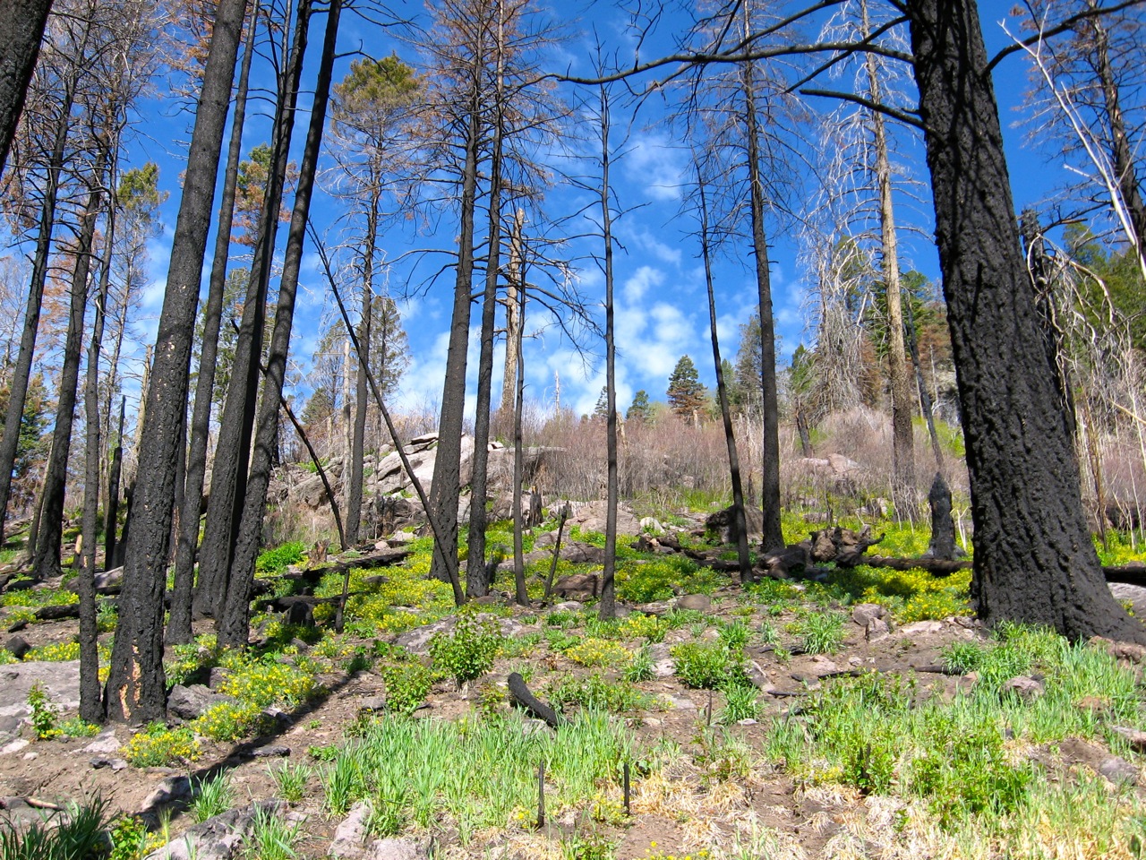
View toward Pajarito Mountain. The non-green trees got scorched in last summer's Las Conchas wildfire. The Las Conchas burn area, like Cerro Grande's burn scar, which the Quemazon Trail is part of, will recover.
Tuesday, May 29, 2012
Perfect Hike to Cerro Grande
Four of us hiked up Cerro Grande this morning. What a perfect day - no wind, no looming thunderstorms. The new route traverses back and forth making it slightly longer than the old, straight-up path but easier. Lots of wild iris, mountain parsley and dandelions made for a colorful hike!
A crew of firefighters stationed at Bandelier, both men and women, preceded us up the mountain. They hauled up large, rectangular plastic containers (looked like jerrycans) full of water. On the summit, they practiced walking while holding 20 pounds of water overhead, lifting a container that resembled a giant, round football.
The spindly trees surrounding the summit are courtesy of last summer's Las Conchas wildfire. The trees had nicely survived the 2000 Cerro Grande fire. In many instances, though, what Cerro Grande didn't burn, Las Conchas finished off!
After the group drove away, I sat on a shady log to eat. Then, it being such a beautiful day, I stalled going home by picking up trash around the trailhead which included a Fosters beer can and plastic bag of dog poop, both which someone had "thoughtfully" tucked into the crook of a tree near the trailhead sign!
| Redondo from Cerro Grande |
| looking north from Cerro Grande's summit |
Friday, May 11, 2012
Hillsides of Golden Smoke Wildflowers
Could it be cosmic irony when today I beheld hillsides of golden smoke wildflowers along the Cañada Bonita Trail, in the Las Conchas burn area?
![]() |
| golden smoke (Corydalis aurea) carpets a burnt hillside above Cañada Bonita Trail |
![]() |
| looking south from Cañada Bonita Trail at slopes of Pajarito Mountain Ski Area |
![]() |
| clouds beginning - thunder rumbles heard on walk back |
Wednesday, May 2, 2012
Enchanted Canyon
I am enchanted by this tiny canyon. Actually, it's the mouth of the canyon between Kwage Mesa and the Big Rock Loop-Sioux Street area of North Mesa. It meets Pueblo Canyon right across from the eastern outlet of the Tent Rocks Trail. So far, I've only gone into the canyon to where the double headwalls are, where the canyon seems to split. This small chunk of canyon has it all - pumice walls, perched boulders, tent rocks, a sandy arroyo bottom. It would be worth exploring further one day.
Wednesday, April 25, 2012
Clouds Seen from Potrillo Canyon Trail Near White Rock, NM
OK, I grant you that Montana is known as Big Sky Country but New Mexico definitely deserves the title too! It always amazes me that for all our aridity, the most amazing cloud shows fill our skies.
Thursday, April 19, 2012
Exciting New Hobby for Recent LANS Retirees
Did you recently take the Voluntary Separation Package offered by Los Alamos National Security? Do you now find yourself lying on the couch, bored and lethargic from watching too much TV? Would you love to take up a challenging new hobby, one with life-changing potential? If the answer is yes, then please sign up for tightrope walking lessons now being offered in a canyon near you!
Monday, April 16, 2012
More Pueblo Canyon Rim Trail Oddities
Last Thursday, took a jaunt on Pueblo Canyon Rim Trail, starting from the Los Alamos Airport.
The "diving board with handrails all around" is north of the airport terminal. There are actually two of them, side by side, with splendid views into Pueblo Canyon. I've wondered for years about the origins of these "viewing platforms and what they were used for.
The "storm drain pipe from airport fence into Pueblo Canyon" is actually part of the trail, i.e., you have to step across the very top of it. There is a wooden fence at this very steep drop off along the trail. I always admire the steep way down but don't think I'll take it.
Friday, April 6, 2012
Pasque Flowers Along Gonzales Road
Another good year for Pasque flowers along Gonzales Road. Looking for them is like an Easter egg hunt for adults. At first you see nada but if you look more closely, you'll see scads!
![]() |
| Pasque flowers along Gonzales Road |
![]() |
| Barranca Mesa cliffs from Gonzales Road |
Subscribe to:
Posts (Atom)