 |
| Despite snowing and raining all day yesterday, May 1, the weather didn't win! The Monday group was able to do its scheduled hike this morning - up the Satch Cowan Trail and then up the Quemazon Trail to Pipeline Road. Trails were in good condition. We even enjoyed "visiting" winter as there was light snow alongside the trail the closer we got to Pipeline Road. The Wooten's Senecio (hopefully the right name) grows quite happily in the snow. Beautiful views of a still amazingly snowy Pajarito Mountain. Some aspens have already leafed out in that innocent-springtime-green while others are just in bud. We saw a Steller's Jay, a big red-tailed hawk perched on a tall snag, and heard the fleeting, Tinker Bell sound of passing hummers. |
Monday, May 2, 2016
Quick Shot from Satch Cowan Trail


Thursday, April 28, 2016
Dome Road Winter Redux
I took these last week after Monday's big snow dump in the Jemez. A few cow elk were roaming the woods but not much else except for me.
 |
| Alamo Boundary Trailhead along Dome Road/Forest Road 289. Rabbit Ridge in background. Can't wait to hike this again. It's always so pretty in the spring with the wild irises blooming. |
 |
| Dome Road swirls on past Graduation Flats (left) and Sawyer Mesa Road/Forest Road 287 (right). |
 |
| Graduation Flats meadow. |
Monday, April 18, 2016
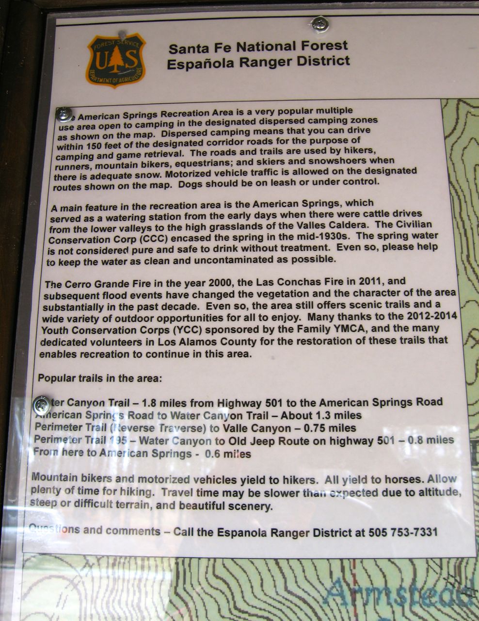
American Springs Trailhead Map Display
To my wonder and amazement, last week I "accidentally" noticed this informative map displayed at the parking area for Forest Road 181, aka American Spring Road. Over the years, I have not seen much of interest posted here by the forest service so I basically ignored the brown, roofed structure. It looked decrepit. The week before, though, I saw a forest service employee busily sprucing it up. It looked like he was applying stain. Maybe that's when the map was posted.
The map shows the trails for the "American Springs Recreation Area" and where dispersed camping is allowed and which roads vehicles can drive on per Santa Fe National Forest's Travel Management Plan. Kind of neat to see such helpful signage!


The map shows the trails for the "American Springs Recreation Area" and where dispersed camping is allowed and which roads vehicles can drive on per Santa Fe National Forest's Travel Management Plan. Kind of neat to see such helpful signage!


Tuesday, March 8, 2016
First Time This Year on American Spring Road
I was going to title this "The Good, the Bad and the Utterly Ridiculous"...
 |
| This small, fallen ponderosa is last in line downhill from a row of ponderosas (and even a fir!) that sprouted along the road after the 2000 Cerro Grande fire. It appears the shallow-rooted tree was undermined by the drainage ditch the forest service dug several years ago. This was to stem erosion caused by flooding after the 2011 Las Conchas wildfire. (BTW, officially, American Spring Road is Forest Road 181.) |
 |
| The above-mentioned row of post-Cerro Grande conifers. I always look forward to seeing their progress toward becoming tall ponderosas like those in the background which didn't burn! |
 |
| The first 2 miles (as far as I walked) of American Spring Road are dried out. This remnant snowfield is at the side of the road going into Water Canyon. Only a taste of winter remains. In the newly melted out meadows that I saw, the grass is still matted down from winter's heavy snow pack. About a month ago, I pulled into the forest road's unplowed parking area, just off NM4, and saw the road was still in deep snow cover, marred by tire track ruts. I didn't attempt to walk the road then. A lot of melting has occurred since - maybe too much, too fast. |
 |
| Quick - someone call a plumber!! Looks like Armstead Spring has sprung a leak!! Pour, Armstead, down Water Canyon!! All the moisture we received this winter is the "Good" in my discarded title (see top of post)! No wildflowers yet but seeing the wild rose's red canes makes me long for the blooms of springtime. I'll even be happy this year to see the pink flowers of that thorny hikers's nemesis, New Mexico locust! |
 |
| This would qualify as the "Ugly". This peaceful and pretty meadow, about 2 miles in from NM4, is used often as a mud proving grounds. Poor neglected, disrespected meadow! |
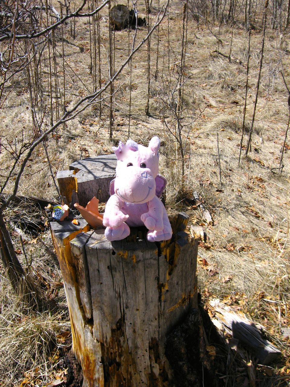 |
| Yes, always bring your "Lovey" with you when you shoot in the forest! This would qualify as the "Utterly Ridiculous"! This is the same meadow above and when it's not a mud proving grounds, it doubles as a shooting gallery! |
White Rock Canyon from Blue Dot Trail
Yesterday, the Monday group, five of us, went down the Red Dot, then along the River Trail and up the Blue Dot. I go down the Red Dot Trail in slow motion. I feel like I'm descending a steep, dry waterfall. In some places, I use the "seat of the pants" method to negotiate the boulders.
I was surprised there aren't more wildflowers blooming yet. Only saw a few verbena and some spindly golden smoke. Maybe that was because my attention was on surviving the "trip" down the rocky trail! Once in White Rock Canyon, I absolutely love the River Trail. It's a whole different world down there with all the beautiful basalt boulders, the petroglyphs, the Rio Grande flowing and the splendid Pajarito Springs forever tumbling into its pool.
Going up the Blue Dot Trail, not too bad. Lots of switchbacks wind up the side of White Rock Canyon and before you know it, you're crawling out at the Blue Dot trailhead and are much pleased with yourself!
 |
| On the way up the Blue Dot Trail, I took lots of "enjoy the scenery" breaks. Rio Grande in midground, Buckman Mesa/Otowi Peak on left, Caja del Rio plateau on right and Sangre de Cristos in far background. |
Monday, February 29, 2016
Rito de los Frijoles Rock Jumble
 |
| Today, in Bandelier National Monument just off the Falls Trail: Rito de los Frijoles tumbling over a rock jumble. On the hike: Saw mountain lover growing on shady part of trail. Near Upper Falls, the Mormon tea looks very robust and bright green. At the Upper Falls overlook, a red-tailed hawk graced us with a flyover high above Frijoles Canyon. The sun shone bright through its red tail feathers. Trail is in good condition. |
Virga Over the Dome from Burnt Mesa Trail
 |
| Yesterday, looking south from Burnt Mesa Trail at San Miguel Mountains: Boundary Peak on left (sharp) and St. Peter's Dome on right. Burnt Mesa Trail is almost completely dried out. Sky trying to do something - looks like virga over the Dome. Saw several waves of cranes heading north and a herd of nine doe deer watching me while I watched them! Impressed by the work someone has done to remove stout fallen trees off the trail. Amazed by the many mounds where ancestral puebloans dwelt. |
Saturday, February 27, 2016
Dome Road Winter Walk
Walked on Dome Road Thursday - only went as far as the intersection of Dome Road and FR36, just a little past Graduation Flats. Someone had driven in on snow-covered Dome Road at that turnoff. Other times I've been there this winter, the snow was too deep for anyone to have driven on and the only tracks were from cross country skiers. It was so tempting to just turn onto Dome Road and walk in the vehicle tracks and I did but only for the merest distance. I knew I had to save my energy, in short supply that day, for the walk back. Besides, when would I have wanted to turn back? Wish I could have walked the whole road and then called for a ride back!
 |
| On Dome Road, FR289, in Bandelier National Monument, not too far from NM4, looking back at contrails. Saw lots of signs that elk have been running around in the forest and back and forth across the road but saw not a single one. Before this week's Tuesday, February 23, snowfall, the road was almost completely dried out but after the infusion of new snow, there are long strips of snow on the sides and in the middle. The road is plowed for access to private property. The gate at NM4 is locked until April 15. |
 |
| Is it perverse to consider the burnt woods beautiful? Maybe so but I do like their colors and their starkness. This is on the Scooter Peak side of the road. The burnt trees are the aftermath of the 2011 Las Conchas wildfire. This June, it will be 5 years post-fire. A lot of these dead and standing trees will surely topple this year. Even among the starkness, though, there is always new growth of young aspens. |
 |
| This is on the side of the road where Bandelier's Upper Frijoles long ski trail is. I never noticed this stock pond before. This winter's snowfall has really filled it up. |
Friday, February 19, 2016
Upper Falls Yesterday
I haven't walked the Falls Trail in Bandelier National Monument since the construction detour instituted last year and, really, not much since the lower part of the trail was destroyed after the August 2011 Las Conchas flooding. But yesterday, along with a friend, I walked the trail once again.
The Falls Trail now dead ends at Upper Falls. Look at the photos of the August 2011 Las Conchas flood damage to the trail and you'll understand why - the portion of the trail that went just past the Lower Falls was undercut and washed away. I remember that section as very steep and slippery (with somewhat slaty-looking rock) even before the cataclysmic trail destruction.
Yesterday, the trail was mostly ice free and the Rito de los Frijoles flowed in pretty riffles and runs down canyon. The tall, red-trunked ponderosas were lovely to see. At Upper Falls, I sat enjoying the cascade of water. It seemed to have more water than I remembered.
The Falls Trail now dead ends at Upper Falls. Look at the photos of the August 2011 Las Conchas flood damage to the trail and you'll understand why - the portion of the trail that went just past the Lower Falls was undercut and washed away. I remember that section as very steep and slippery (with somewhat slaty-looking rock) even before the cataclysmic trail destruction.
Yesterday, the trail was mostly ice free and the Rito de los Frijoles flowed in pretty riffles and runs down canyon. The tall, red-trunked ponderosas were lovely to see. At Upper Falls, I sat enjoying the cascade of water. It seemed to have more water than I remembered.
 |
| Add caption |
Thursday, November 19, 2015
Skating on Mud - American Spring Road/FR181
Today I walked up lower American Spring Road/FR181 from the twin water tanks on West Jemez Road. It snowed last week and I wanted to check if the mud was drying. Conditions were good until the rutted mud bog just past the Perimeter Trail turnoff. My shoes sunk and slid sideways with each step. Several times I tried to escape to the side of the road but my feet just slid backward each attempt. There wasn't anything to do but slip and slide until I achieved drier ground. I drew arrows pointing to the road sides to alert me to avoid this going back! Right after, I actually saw another hiker! He was headed downhill so I warned him of mud ahead. He said he'd walk around it - wish I had! We concurred that even with mud, it was a wonderful day to be out - sunny, intensely blue skies and really rather warm!
The drainage on the eastern half of this forest road is so poor that when it rains or snows, the middle section deteriorates into a series of epic puddles stitched together by mud. After the mud bog, though, the road is flatter and I could always find a less muddy path. When I made it past the last giant puddle, rather than retrace squishy steps back to the car, I decided to continue out to the upper parking area off NM4. This meant that the faithful car would be downhill and a mile away! To be reunited, the choices were to walk down a very narrow, steep portion of the NM4 that locals call "the escarpment" or hitchhike! With a sheepish grin, I stuck out my thumb for a car but when it continued past, I started walking down! (Could it have been the grin!!)
The drainage on the eastern half of this forest road is so poor that when it rains or snows, the middle section deteriorates into a series of epic puddles stitched together by mud. After the mud bog, though, the road is flatter and I could always find a less muddy path. When I made it past the last giant puddle, rather than retrace squishy steps back to the car, I decided to continue out to the upper parking area off NM4. This meant that the faithful car would be downhill and a mile away! To be reunited, the choices were to walk down a very narrow, steep portion of the NM4 that locals call "the escarpment" or hitchhike! With a sheepish grin, I stuck out my thumb for a car but when it continued past, I started walking down! (Could it have been the grin!!)
 |
| Looking into upper Water Canyon and east toward the Sangre de Cristos Mountains. |
 |
| American Spring Road/FR181 as it climbs out of upper Water Canyon. This part of the road, with its shoe-cleansing snow, was pleasant to walk on. |
 |
| Looking east across my favorite meadow (that some call Sawmill Meadow). I was surprised that there is practically no snow in the meadow! Nice that there is snow in the Sangres! |
 |
| On the way down "the escarpment", looking at the white and yellow paint on the trees from the September 2012 accident where a road striping paint truck went over the guardrail. It still looks fresh! Thankfully, the driver survived!! |
Subscribe to:
Posts (Atom)